City of Boston Education Institutions EDA
Source materials
Here is a list with links to the jupyter notebook and original dataset used to generate the findings on this page:
-
The original City of Boston public schools data can be found online here.
-
The original City of Boston non-public schools data can be found online here.
-
The original City of Boston colleges and universities data can be found online here.
Summary and challenges
We have examined public K-12 schools, non-public K-12 schools, as well as colleges and universities in the Boston area. We’ve cleaned and prepared
- 131 Public K-12 Boston area schools
- 82 non-public schools
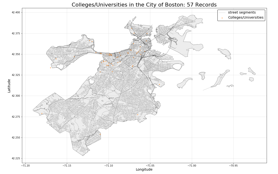
- 57 colleges/universities.
Distributions on Boston Map
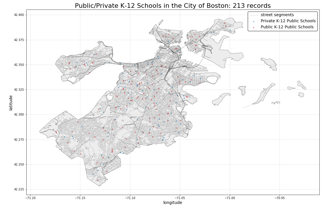
All K-12 Schools (Pubic and Private):
All Colleges and Universities:
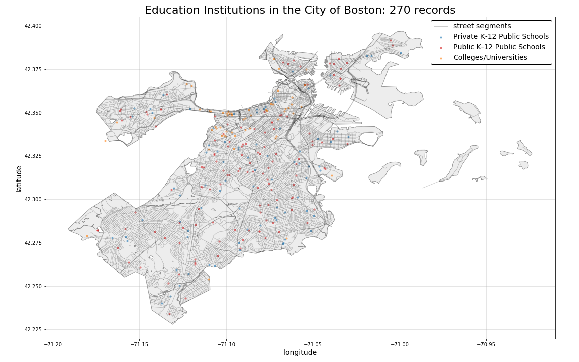
All Education Institutions:
The plot below illustrates the combined 270 education institutions differentiated by color. All education institutions include geographical coordinates and are ready to be utilized within our models.